How to resolve AdBlock issue?
 - Elizabeth Larson
- Posted On
Lake County under flood watch through Saturday
The National Weather Service issued the flood watch, which took effect at 5 p.m. Friday and will continue until 5 p.m. Saturday.
For the northern third of the county, which include Mendocino National Forest lands, a wind advisory will be in effect from 12 a.m. to 6 p.m. Saturday.
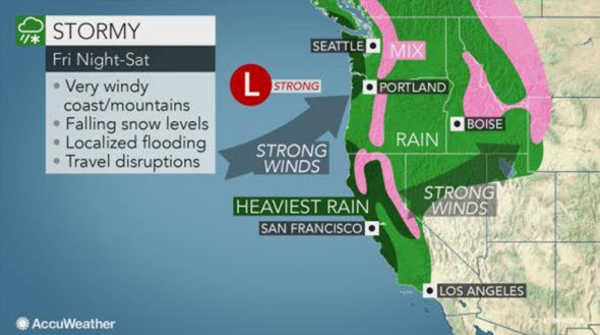
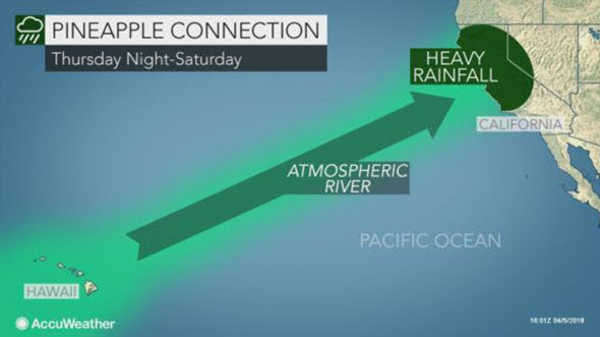
The flood watch is due to a forecast of more rain to come due to a strong atmospheric river that began moving over the region on Thursday.
The heavy rain could cause creeks and streams to rise and flood, forecasters said.
The storm so far, which began late Thursday and continued through most of Friday, has brought some of the heavy’s heaviest rain so far.
The 24-hour rainfall totals through 5:45 p.m. Friday recorded by National Weather Service observation stations are as follows, recorded in inches:
– Boggs Mountain: 1.56;
– Clearlake city alert: 1.80;
– Clearlake, Mira Vista road alert: 1.67;
– Colusa County line: 2.07;
– Hidden Valley Lake: 1.75;
– Lakeport: 2.52;
– Lower Lake near Cache Creek: 1.50;
– High Glade Lookout (north of Upper Lake): 3.29;
– High Valley Road alert: 2.74;
– Indian Valley Reservoir: 2.33;
– Soda Creek: 3.91;
– Upper Lake: 2.82;
– Whispering Pines: 1.88.
On Friday evening, Clear Lake’s level had risen to about 4.2 feet on the Rumsey gauge, the special measure for the lake, according to the US Geological Survey stream gauge.
Moderate to heavy rainfall is expected to continue through Saturday, forecasters reported.
On Friday night, rainfall totals could range from three-quarters of an inch to an inch in Lakeport and Kelseyville, and between 1 and 2 inches in the Middletown and Upper Lake areas, according to the forecast.
Lesser rainfall amounts – totaling out at about a quarter of an inch – are forecast for Saturday, before conditions clear. Then forecasters predict chances of rain will return from Tuesday through Thursday.
Accompanying the weekend rain is wind, with gusts of more than 20 miles per hour forecast on Saturday and Saturday night.
Temperatures on Friday night are expected to drop into the 50s. On Saturday, daytime temperatures in the high 50s are forecast, dropping into the low 40s at night; Sunday will see slightly warmer temperatures into the low 60s at night but still in the 40s at night.
Slightly warmer conditions are forecast early in the new week before once again getting colder midweek.
Email Elizabeth Larson at This email address is being protected from spambots. You need JavaScript enabled to view it.. Follow her on Twitter, @ERLarson, or Lake County News, @LakeCoNews.